


DESCRIPTION
Diving in Leros
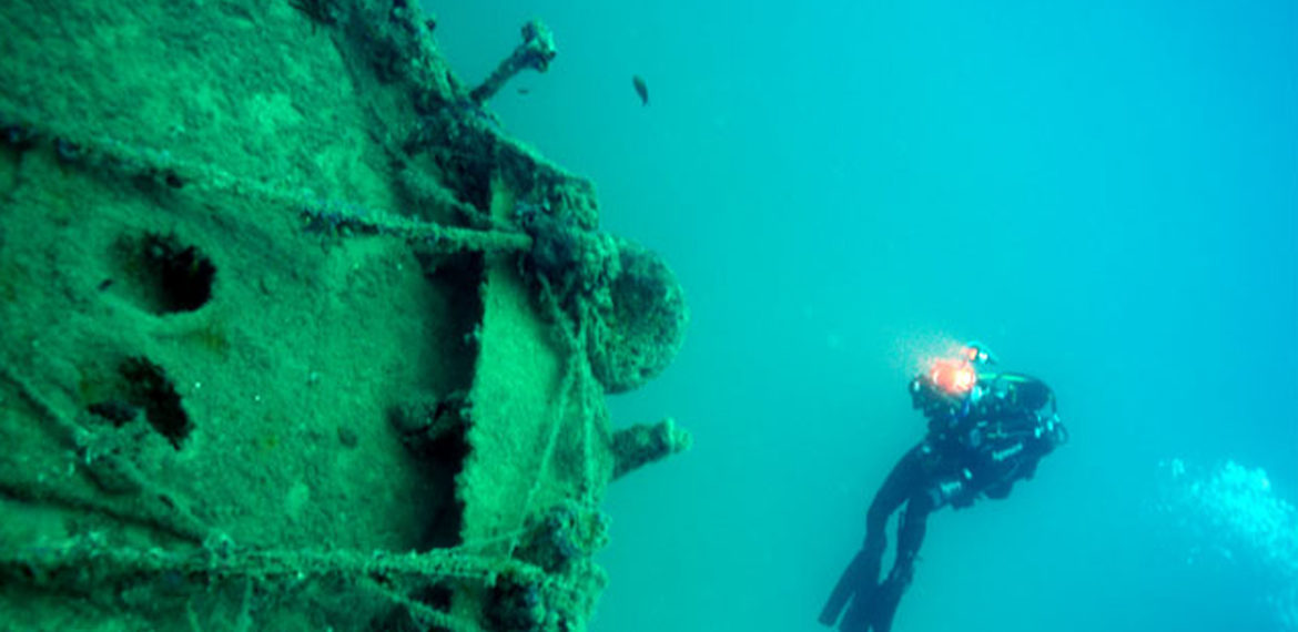
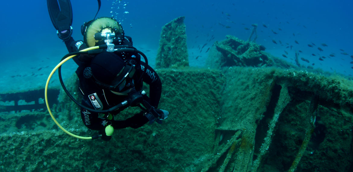
Leros hides in its waters the most “living” shipwrecks in the world, second only to Normandy! Besides, its “Poseidonia” is considered one of the richest in the Mediterranean. Discover an incredible underwater Museum and travel back in time, under the guidance of a professional diver. Leros has great potential to develop into a most unique destination for diving tourism. Here are some of the reasons why:… It should, however, be noted that diving is only allowed in specially delimited areas. These areas are unique in the world.
A big dive in history…
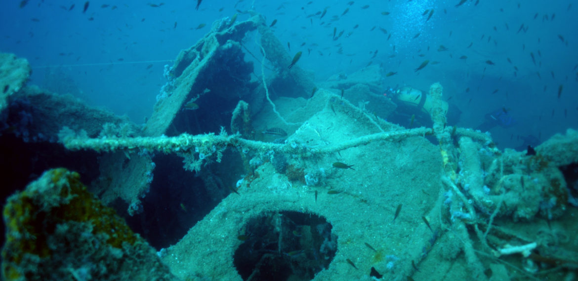
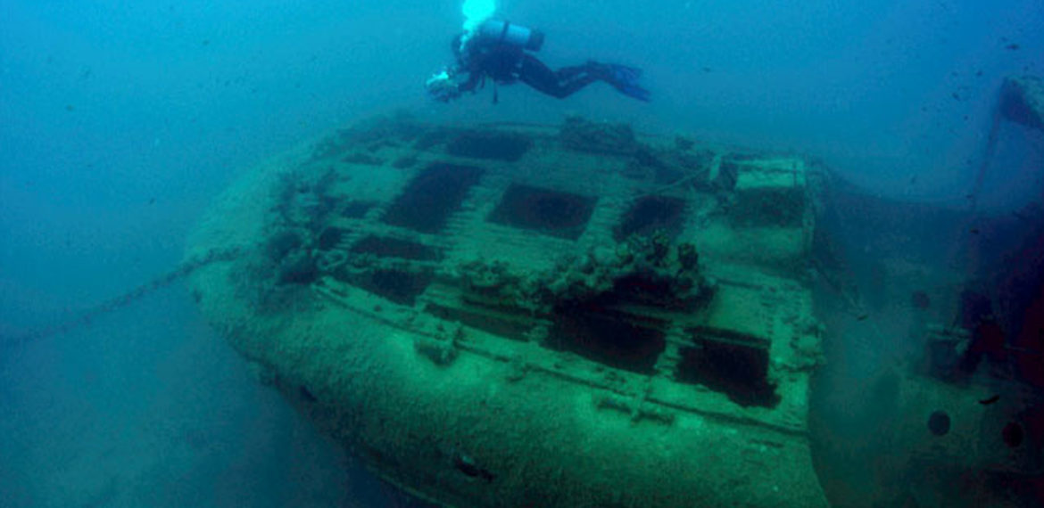
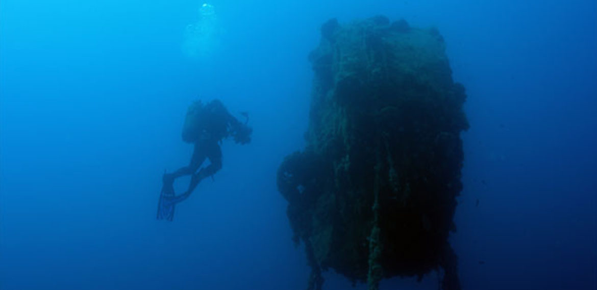
First dive, a type “H” German landing craft. As the German army wanted to divide the island in two, a small fleet of landing crafts set off from Kalymnos to land in three different spots. One of them was carrying the III/440th Grenadiers battalion. The 899th Battery, from Pleiodoti, opened fire and a shell hit the rudder.
Adrift, the ship circled the island of Stroggyli repeatedly hitting the rocks, the ammunition it was carrying exploded, fire broke out and the ship sunk. The 35 Germans who survived hid in the northern part of the island, where, two days later, exhausted, they were taken prisoners by the Italians. The depth is up to 20 metres, visibility is good and, in many locations, the portable equipment can still be seen around the landing craft, which is cut in two.
The next dive is in Partheni, at cape Korais. A Greek barge had been requisitioned by the Italians and was used to draw the anti-submarine boom. The propeller had been removed (so that it does not get tangled up in the net) and it was propelled by two motors installed one on the bow and one on the stern. As the shipwreck is next to a fish farming facility, visibility is limited, but in no way did this prevent us from taking a dive. During the time the island was being bombarded by the Germans, the ship was also hit by a torpedo; the hole in front of the bridge of the ship reveals the extent of the explosion.
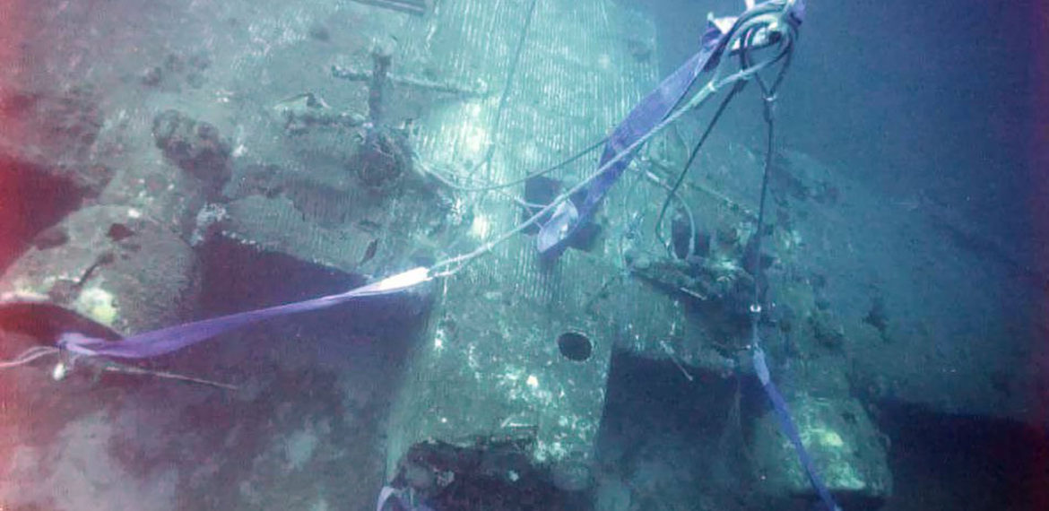
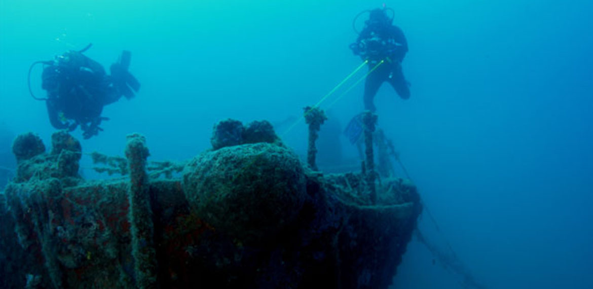
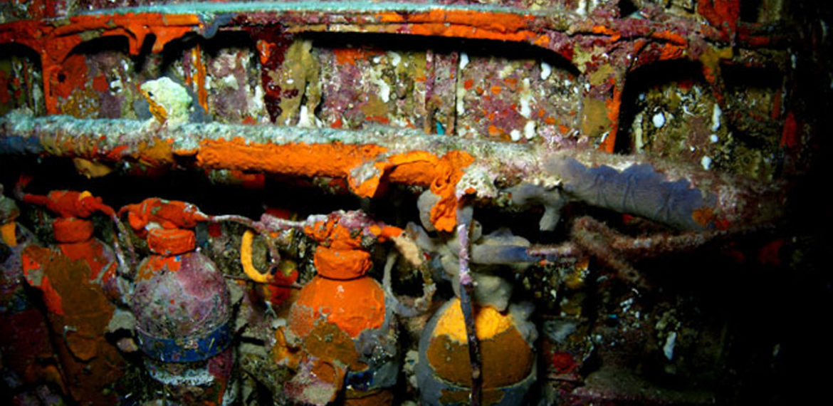
Our next dive is at the mouth of the port of Lakki. Even before the war, the Italians had begun to fortify the island, placing cannons on the coasts and anti-submarine nets. At the entrance of the port of Lakki, they had placed anti-submarine nets on three levels. The net was tied on the rocks by chains and buoys. Once we leave the surface, the first pieces of the net, now tangled up in balls, become visible, while, as we go deeper the largest part of the metal mesh is better visible. As we continued\ our dive, pleasant surprises await as we run into a school of parrotfish and a grouper out on its morning walk.
Then come our dives in Belefoutis, at the fuselage of a Henkel 111 bomber, at a depth of 16-18 metres.
In lower Zymi, there is a wall at a maximum depth of -30 metres.
These dives in clear, blue water with high visibility, will particularly move photography lovers!
As for us, we look forward to a particular dive, in the port, a dive of historical interest , at the legendary destroyer, Queen Olga.
SHIPWRECK HISTORY:
- Type H German landing craft
It sunk in November 1943 after taking fire from the PL888 battery in the Blefoutis hill. It sunk north-east of the Storggyli islet. The shipwreck rests at a depth of 12 to 20 metres.
- Cargo ship north-west of cape Korais
The ship had been converted, in order to draw the metal anti-submarine mesh from one end of the Partheni gulf to the other, securing and controlling the eastern opening between cape Korais and the Archaggelos islet. It was sunk by a German aircraft torpedo. The shipwreck rests at a depth of 34 to 43 metres.
- Technical support barge of the antisubmarine net:
It lies at a depth of 38 metres, in the Partheni gulf.
- JU 52 aircraft
It is a three-engine aircraft, with an 18.90 m fuselage and a wing opening of 29 metres. The airplane was transporting parachutists and was shot down after dropping them over the Rachi hill. It landed on the water, north-east of Leros and now rests at a depth of 48 metres.
- Heinkel 111:
It lies, sunk, at a depth of 16 metres, north-west of the Belefoutis gulf. It was dragged by the nets of a fishing boat and moved.
- Cape Katsouni antisubmarine net:
It would protect the gulf of Lakki. It was tied on both ends of the mouth of the gulf and was drawn in and out of the water by a mechanical winch placed on the northern side, to allow boats to go in and out. It lies at a depth of 14 to 55 metres, which is the maximum depth of the gulf.
- Piganousa islet cave:
The cave is at a depth of 16 metres and is a sample of the biodiversity of the area.
- Arado Aircraft:
It is situated east of Cape Mavros Kavos, at a depth of 20 metres. It ended up there drawn by the nets of a fishing boat.
Video
Location
Contact
- Address: Directions


